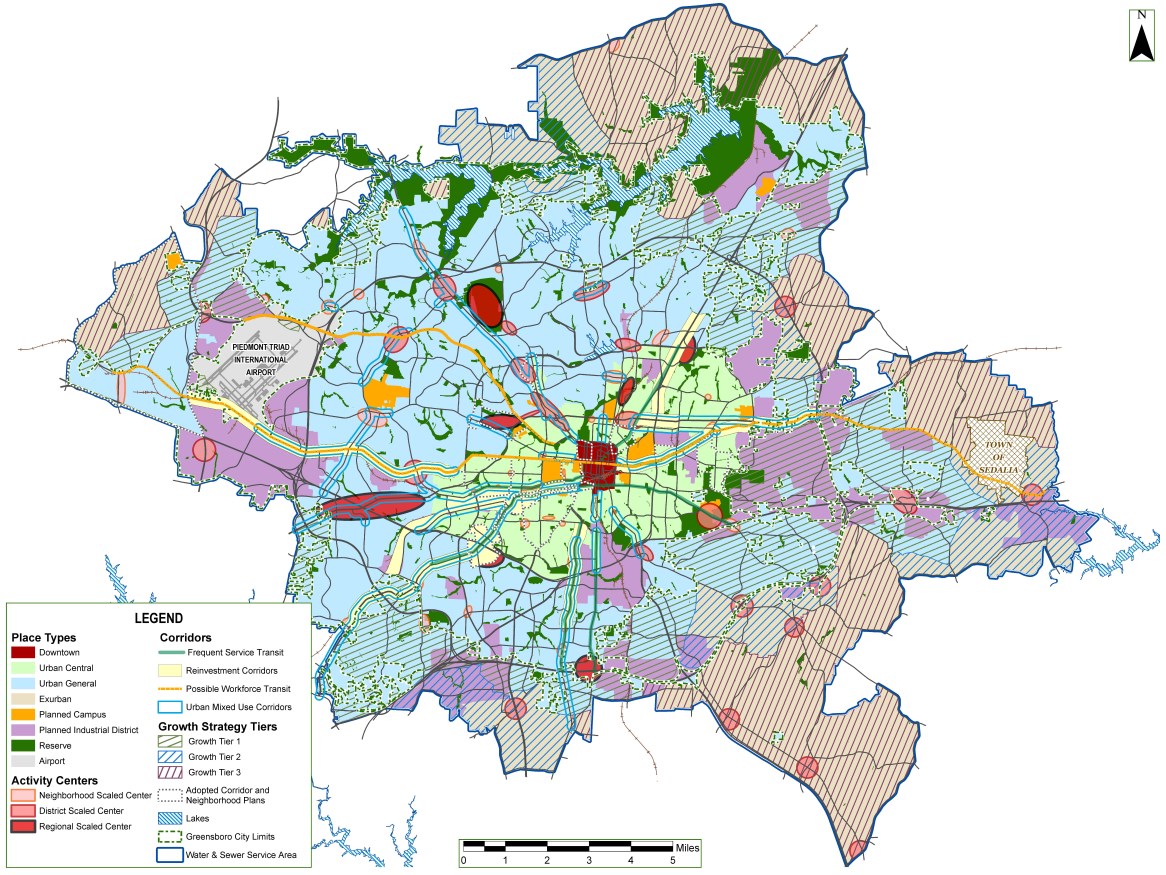
Map 8: Future Built Form
The Future Built Form Map illustrates how areas of the City are envisioned to develop in ways that can help create a more desirable and sustainable Greensboro.
Areas were designated based on a variety of considerations including historic and current development conditions, the function of roadways that serve them, their overall location in the City, and other nearby land uses. In addition to the more universal development review considerations of the Future Land Use Map, the Future Built Form Map is used to identify more specific evaluations for each district.
Place Type designations:
- Urban Core - This place type is Geensboro’s downtown, historically designed to be the center of town from which the growth and expansion of Greensboro radiates.
- Urban Central - This place type has a base of mixed-use development and a more complete sidewalk network.
- Urban General - This place type is the largest area of physical development of Greensboro, and occurred in the “post-WWII” period, reflecting the national trends in development patterns.
The Place Type designations help assure that this incremental growth fits in with and strengthens the existing context.

The Plan focuses most new growth into Activity Centers. Incremental growth is what will create the Greensboro that this plan envisions.
For more information, see Chapter 10, Map 8 in the GSO2040 Comprehensive Plan.
