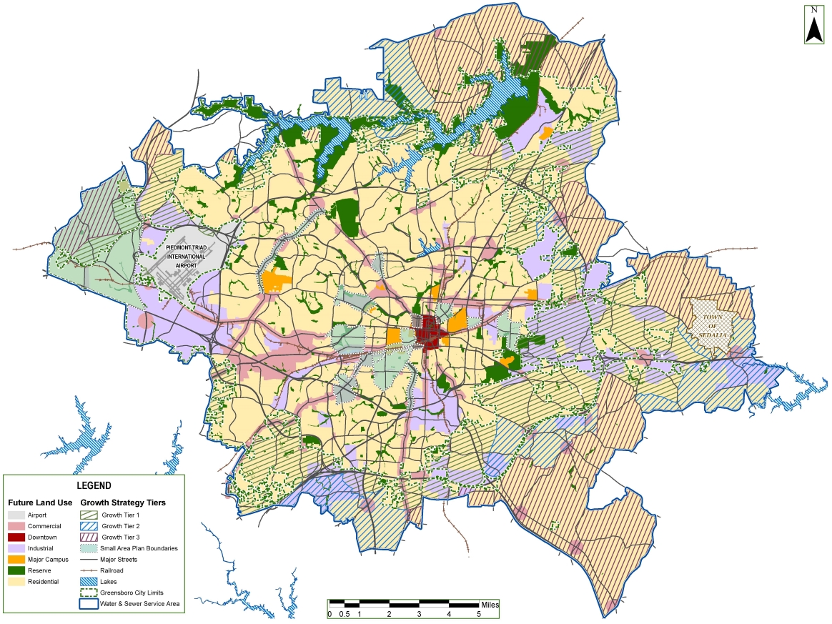
Map 7: Future Land Use Types
The Future Land Use Map broadly describes land use and designates areas for airport, residential, commercial, industrial, mixed use, or reserve.
Requests for changes to zoning must consider the full range of uses and activities permissible within those designations.
The Anticipated Growth Maps show where the City expects to see increases in activity levels, by designating Activity Centers where most change and growth will occur, and describing the type of growth and development that is appropriate to specific areas.
In preparing the Future Land Use Map and the Future Built Form Map, the City considered the current land uses and conditions, physical and environmental features, the availability and capacities of infrastructure to support property uses, and the application of strategies identified in the Plan to implement the Six Big Ideas.

In particular, it is within Activity Centers and along Urban Corridors that the Plan anticipates most increases in walkable, mixed-use development.
For more information, see Chapter 10, Map 7 in the GSO2040 Comprehensive Plan.
